Remote sensing analysis of the Huntly Bauxite Mine
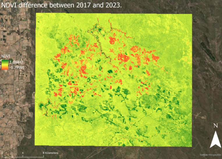
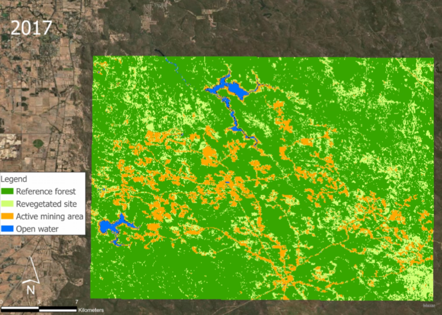
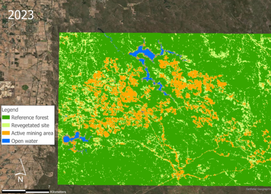
Summary: I developed an interactive ArcGIS StoryMap to assess post-mining rehabilitation in Alcoa’s Huntly Bauxite Mine, located in the northern Jarrah Forest. Using Sentinel-2 satellite imagery from 2017–2023, I applied NDVI analysis and supervised land cover classification to evaluate vegetation recovery across two sub-sites: McCoy and Myara South.
The results revealed successful revegetation in McCoy, alongside continued expansion of active mining areas in Myara South. The classification model achieved an overall accuracy of 76.8%, highlighting both the effectiveness of rehabilitation efforts and the challenges of balancing ecological restoration with mining operations.
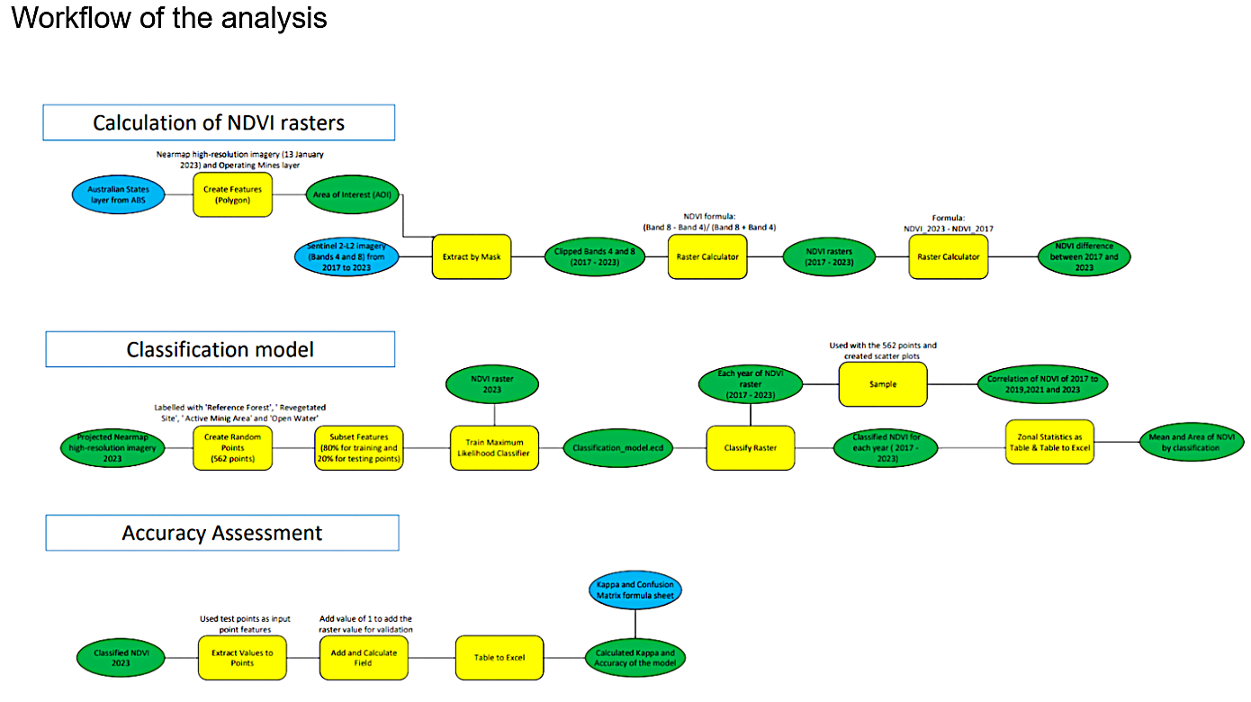
The work demonstrates how geospatial methods can support ecological monitoring, combining technical analysis with visual storytelling to make complex environmental data more accessible. (As the StoryMap is hosted on UWA’s internal platform, selected images from the analysis are included here instead.)